Showing posts with label Storms. Show all posts

Friday, March 22, 2013

Where’s the Lamb?

This morning a colleague commented on winter’s stubborn refusal to exit the scene by wondering “Where’s the lamb?”

The age old adage about March, “in like a lion out like a lamb,” doesn't seem to be holding true this year. According to this report in The Sun, “The National Weather Service is forecasting a 30 percent chance of rain and snow Sunday night and a 50 percent chance of rain and snow on Monday.”

That’s lion behavior.

Since I first stepped out the door in the the morning chill today, I've had this Little Feat song playing in the back of my head.

Wednesday, March 06, 2013

The Perils of Predictions

Pity the poor weatherman. That’s the gist of this article by Joel Achenbach in The Washington Post today. Joel defends the masters of meteorology by stating simply that “Snow is hard.”

“Snow exposes failure. If the weatherperson botches a rainfall prediction, no one notices, because it’s hard for an ordinary person to judge rainfall totals, and the storm sewers gobble up the excess. But someone can detect a bad snow forecast — too much snow, or too little — just by looking out the window.”

He has a point. There is snow on the ground today, but not everywhere. So far at least, the Snowquester has just turned out to be a cold wet mess. The best part is that traffic coming into work this morning was light. The worst part is that the kids are home and the libraries are closed.

Tuesday, March 05, 2013

Spring Snow…Or Not

I enjoy a significant snowstorm as much as the next guy but, as a native Marylander I've grown skeptical of most snow forecasts. Perhaps it’s just my own warped perspective but it seems to me that the worst storms to hit us are, more often than not, the ones the professionals didn't see coming.

On the other hand, even the ever cautious Foot's Forecasters are suggesting that the approaching storm could be problematic. It’s just hard to imagine it right now with the sun shining and the mercury approaching fifty and the fact that we are already five days into meteorological spring.

Then again there’s that whole in like a lion out like a lamb thing…

The Weather Channel folks are calling this storm Saturn but in the DC area the preferred moniker is Snowquester.

Saturday, February 09, 2013

Local Weatherman


As a self professed weather geek I am happy to share the news that a HoCo loco has been named the new director of the National Weather Service. According to this story by Jason Samenow in The Washington Post, the service “appointed 24-year NWS veteran Dr. Louis Uccellini as its next director.”

“In addition to his federal government experience, Uccellini, a resident of Columbia, Md., is one of the co-authors (with Paul Kocin) of the book “Northeast Snowstorms”, a definitive account of the region’s most impactful snow events. With a possible historic blizzard slated for New England Friday, the timing of his appointment is certainly fitting.”

In hearing this news, Ian Kennedy, another loco weather geek wrote on Facebook that he'd like to meet his Columbia neighbor and  "maybe we can just hang out and talk about snow and cold fronts and stuff."

Count me in for that. I'll even buy a round...or two.

Congratulations Dr. Uccellini.

Thursday, January 31, 2013

High Water

It was the storm with no name. Despite the fact that yesterdays weather event included 13 tornadoes in eight states, no one has given it a name, not yet anyway. It was certainly worthy of a name. According to this story by Becky Kellogg on The Weather Channel, over “a hundred homes and businesses in Laurel, Md. were evacuated Thursday afternoon after heavy rains prompted the opening of nearby dams. A commuter rail station in Laurel was also closed because of floodwaters.  Roads in Montgomery County, Md. are closed, and some are even buckling, due to the heavy rain and high water."Wind gusts up to 81 mph were clocked in southern New England early Thursday, including gusts over 60 mph at New York's LaGuardia Airport and Boston's Logan Airport," says weather.com Senior Meteorologist Jon Erdman.”
In HoCo it appears that Ellicott dodged the flood bullet this time around. The bridge crossing the Patapsco River was closed as a precaution but this morning the river was still running under the bridge instead of over it.

It was right at the deck though. Walking across from the Baltimore County side this morning, Dave Carney remarked that crossing over with the river so high made him feel a little nervous.


 It didn't seem to bother Chloe.

Thursday, January 24, 2013

Two Hour Delay


A ripple effect is inevitable. When the school system declares a two hour retreat from the regular start time, the weekday rhythm for homes with school children is upended. At 10:30 this morning there was still a back up on Route 29.

For high school students it always welcome reprieve. Instead of rising before the sun on a cold winter day they get to linger in bed a bit longer, something that most teenagers I know seem to relish as much as anything.

For the rest of us it’s a scramble of rescheduling morning meetings and clearing off cars and driveways. A two hour delay is not a snow day where events are canceled and the there is a real possibility of working from home. A two hour delay day means arriving at work and already being two hours behind.

Sunday, November 18, 2012

Come Along


We did not escape Frankenstorm unmolested. The morning after, a fifteen foot Leland Cypress was listing starboard at a 45 degree angle against our fence. It hadn't toppled over…yet.

After Mama Wordbones and I conducted an amateur arborist triage we determined we needed a rope and a sturdy stake to stabilize the patient. We had rope but nothing in our stake inventory was suitable for a tree this size. We went to Home Depot…and then Lowes…neither of which carried the serious business stake we were looking for. Mama Wordbones suggested Southern States would have what we needed. They did. Mama Wordbones is a former country girl and country people know all about Southern States.

The stake and rope were sufficient to shore up the tree but to straighten her out we needed more muscle. At this point, my early life as a groundskeeper at Merriweather Post Pavilion came back into focus. It was in that point in my life that I learned about a tool called a come-along. “We need a come-along,” I declared.

At first I thought we could rent one. I mean this isn't a tool you use everyday. It could be years before we’ll have a need for it again.

Well, I found out yesterday that you can’t rent one, not at ABC Rental in Columbia anyway. I headed over to Home Depot.

“I’m looking for a come-along,” I said to the guy in the tool department. He looked at me like I had two heads. I gave him a decidedly non technical description of the device and he told me to wait while he found an older guy to deal with me. As I awaited his return I played around with this Rigid heavy duty boom box. A guy wearing a black Rigid jacket comes up and asks if I have any questions about the boom box. “No really, what I really want is a come-along.”

He took me right to them. A one ton come-along cost $31.76. That seemed very reasonable to me.

It worked like a charm too. Once we got it properly rigged to the tree it was easy street to an upright tree. I just cranked that big boy right back into place.

It turns that the proper name for this tool is also called a cable puller. To me it will forever be a come-along, one of the best tools around.

Wednesday, October 31, 2012

Crawling Back to Normal


It strikes me a bit odd that trash collection in HoCo continued on Monday during some of the worst of the storm but was suspended yesterday when the weather had cleared considerably. HoCo trash collection is now the slide schedule for the rest of the week.

Even though a new law took affect on October 1st that requires all Maryland drivers to stop at a non functioning traffic signal, it appears that many folks didn't get that memo. Yesterday while driving between BWI airport and Columbia I repeatedly witnessed drivers who, apparently believing that they had the right of way, continue to roll through intersections with malfunctioning signals at times without even slowing down. This morning, at the intersection of MD 104 and MD 103 in Ellicott City, I saw drivers do this right in front of police officers sitting their cars with lights flashing. I didn't see anyone enforcing the new law.
Yesterday morning CG asked me if I thought Dick’s Sporting Goods would be open. I told there was a about a 75/25 chance that it wouldn't be. Even though the weather had cleared, businesses were slow to reopen. Some banks were open, others were not. A Dunkin Donuts in Linthicum was closed but the Starbucks on West Nursery Road was open. The Starbucks in Shipley’s Grant was open too and it was packed at 1:00 PM.
Today, with schools back in session, loco life returns to normal, at least what constitutes as normal in the week before elections.


Tuesday, October 30, 2012

Frankenstorm: River Watchers


This morning I drove down to Main Street to see how the old town fared last night. After parking in the Old Mill Bakery Café parking lot I walked across the bridge to check out the river.

It was a popular spot. While I was there a steady stream of folks came by to take pictures and videos of the raging waters. This is what they saw.


Unlike yesterday, the Old Bakery Café was closed. Fortunately I saw on facebook this morning that Bean Hollow was open so I grabbed a cup of coffee before heading back up the hill.

People were taking pictures of the water in Columbia too. Fellow HoCo blogger, Clayton, sent me this picture of the Town Center lakefront from this morning. He also noted that “Clyde's and Lakeside Roastery both were open yesterday morning, but not today.”
Thanks Clayton.

Last night we lost power at 8:34 PM but much to our surprise it came back on at 9:20 PM. I salute the men in the yellow slickers and hardhats who labored through the evening to keep the juices flowing. As was pointed out earlier by Marshmallow Man, the Derecho storm this summer may have actually mitigated the damage from Sandy. That storm did a good job of clearing out much of the rotted limbs and weak trees before Frankenstorm arrived.

At WSw it is calm right now. The lowest pressure recorded during the storm was 28.21 inHg at 11:16 PM last night. Right now it has risen back to 28.95 inHg and is headed back up.

Today, life slowly returns to normal.

Monday, October 29, 2012

Frankenstorm: It Blows


For a brief moment, at 3:35 PM, we lost power. Miraculously  it came back on in less than ten minutes. I figure we’re living on borrowed time here so I’d better get up another post while I still can.

This is what Frankenstorm looks like in my backyard with 17 mph wind gusts. 


The winds are beginning to wreak their havoc too. Right now 5,744 BGE customers in HoCo are without power. The good news is that 2,772 customers have had their power restored. I wonder if our litte ten minute outage counts in that restored number?

At WSw the relative pressure is now 28.46 inHg and still going down. Sustained winds of 11 mph are out of the northwest with gusts up to 17 mph. 

If you have HoCo loco Frankenstorm pictures you like to share send them to me at wordbones@verizon.net. I’ll put up as much as I can as long as I can.

Frankenstorm: Stormy Monday


Though the streets are fairly empty not everyone is enjoying the luxury of staying home as Frankenstorm begins to bear down us. In addition to the usual suspects of emergency and medical folks, there are road crews and retailers on the job as well.

At 9:30 AM the Dunkin Donuts on Montgomery Road was open. “We’ll probably close around 2 PM,” Peter told me.

The majority of loco retailers didn't even bother with an abbreviated day. The Mall was open at 10:30 AM but none of the stores were.

 Walgreen's in Columbia and Rite-Aid in Ellicott City were open early this afternoon. The cashier at Walgreen's said she wasn't sure when they’d be closing.


Driving through Ellicott City I noted that The Wine Bin, Phoenix and the Old Mill Bakery Café were all open. Some closed stores had windows boarded up, others has sandbags blocking the doorways. HoCo road crews were blocking off Parking lots A&B, along the Patapsco River.

In addition to the rain, some loco roads are also covered in leaves making traction a little dicey in certain spots. 
It’s starting to get a nasty out there. WSw has started registering wind gusts up to 14 mph with sustained winds around 8 mph. The temperature has dropped to 48.2 degrees with the added wind chill it’s 38.3 degrees. Relative pressure is now 28.89 and still heading south. The WSw rainfall monitor doesn't seem to be working. It is showing 0.00 rainfall so far and any fool could see that aint right.

It’s only going to get worse. Around six tonight, Foots forecasters tell us to expect sustained winds of 40 to 60 mph. From nine to midnight that element of Frankenstorm ratchets up to “occasional gusts to Hurricane Force (~74 mph).”

HCPSS has announced that schools will be closed tomorrow too.

They call it Stormy Monday but Tuesdays just as bad…

Sunday, October 28, 2012

Frankenstorm: Sunday Night


We decided to take in a matinee today. With loco authorities asking us to stay off the roads tomorrow, Mama Wordbones and I figured it would be a good idea to get out of the house before Frankenstorm started limiting our options.

It was actually my second movie this weekend. On Friday night Peanut and I went to see Cloud Atlas in Town Center. As we were leaving, I ran into Chris Oxenham and his fiancé, Nicole Mele. They were catching the 9:00 PM showing of Argo. That’s the movie we saw this afternoon.

We expected to find a full parking lot at the Snowden cinemas but discovered just the opposite. We took an umbrella inside with us. It was a two hour movie beginning at 4:00 PM.

The umbrella was not necessary. When we headed to our car there was only a light drizzle.

It seems like everything is closed tomorrow except HoCo trash service. Those guys are Frankenstorm studs.

It’s on our doorstep and the Foots Forecasters say “This is why it's called the "Frankenstorm…Consider, at the same time, we have a:" 

"*Blizzard Warning in Garrett County,Maryland and portions of West Virginia;
*Hurricane Force Wind Warnings for the Chesapeake
*High Wind Warnings for all of Maryland
*Hurricane Warnings off the coast of Ocean City."

In other words, a monster storm.

HoCo loco conditions are beginning to worsen. At WSw, relative pressure continues to drop, currently at 29.33 inHg and falling. Winds, coming out of the northwest, are beginning to gust at 7 mph. It’s 52.2 degrees and a light rain is falling

Frankenstorm: Giving Up the Ghost


Every year, my neighbor Peter goes all out for Halloween. His front yard ghoulish display is among  the best I've ever seen. Each year he even adds a new character or prop. Last year it was a full sized coffin. This year it was the Mummy. A larger than life Frankenstein is a standard feature of the tableau.

Frank and the Mummy have retreated into the garage. It’s a wise move. They may inflict shivers and chills on children but they are no match for Frankenstorm. Yesterday, three days before Halloween and in the face of Frankenstorm, the display came down.

I’m thankful too. Fifty mile an hour winds could easily put Peter’s monsters on the move. I like them just fine in his yard but not so much sticking their heads through the screens on my screened porch.

Our display is much more modest. Since CG was just a little girl Mama Wordbones has always put a simple little homemade ghost in a front yard tree. That ghost is gone now too.

Peanut got some good news this afternoon. HoCo schools are giving up the ghost too. HCPSS announced at noon that public schools will be closed tomorrow.

At WSw the temp is now 56.3 degrees, and humity is 66%.  Pressure continues to drop at 29.42 inHg. Average wind speed has doubled to 4 mph.

Baby steps of the beast

Frankenstorm: Sunday Morning


I believe we’re going to lose power. In my mind it’s only really a question of when. Our neighborhood doesn't do well in storms. Almost any storm worth its alert results in some sort of power outage for us.

This morning I asked Mama Wordbones when she thought we’d lose it.

“I don’t know but you’d better bring the coolers up from the basement today.”

That’s just another one of the things we’re doing for Frankenstorm. Yesterday we secured the outdoor furniture and cleared off the deck. I weighted down anything that had the potential to become airborne.

We will begin to feel Frankenstorms footsteps today. According to last nights posting by Foots Forecast Central Maryland team,  Hurricane Sandy “will be approaching from the southeast, cloudy skies with rain mainly in the afternoon with highs around 60 with northeast winds 15 to 20 mph with gust up to 30 mph. Sunday night rain with north winds 20 to 25 mph with gust up to 40 mph.”

The meteorological monster is now expected to arrive on Tuesday.

It’s still pretty calm here at WSw. The current temperature is 55 degrees with 64% humidity. The relative pressure is currently 29.51 inHg but it has been steadily dropping since Friday. Winds have begun to register at 2 mph.

Saturday, October 27, 2012

Frankenstorm: Prelude 2


It’s alive and, at the moment at least, we are pretty close to ground zero. According to the 6:30 AM posting on the Foots Forecast Central Maryland page, we are now looking at “12"+ of rain for coastal Delmarva and up to 8" for the western shore including Central Maryland.”
  
“The Maryland Team is working new graphics and statements to be issued here and on the main site this morning. This is part of our usual round of pre-storm consults with local emergency management. We always make sure they're informed of the bad news first. But don't wait for us, if you haven't made the trip to Sam's Club or Costco, go now while there's still a parking space left.”

More than a few of us started getting ready yesterday. Around noon, Costco in Gateway Crossing was packed. One of the employees told me that they had already been through several pallets of bottled water.

I bought a case, along with batteries and a rain jacket for Peanut.
If you wanted to grab a generator you were probably already too late. According to this story by Scott Dance in The Sun “portable generators were in high demand and short supply at local hardware stores.”

And people are going to lose power. BGE currently estimates that 700,000 of their customers will lose power during Frankenstorm. They are already bringing in crews from out-of-state to handle the expected workload. With sustained winds expected to exceed 50 mph over two days, even the extra crews won’t insure a timely restoration of power. You can’t use the bucket on a bucket truck once winds exceed 35 mph.

If you need help in deciding how to prepare, FEMA has a smartphone app with “disaster safety tips, interactive lists for storing your emergency kit and emergency meeting location information, and a map with open shelters and open FEMA Disaster Recovery Centers (DRCs).”

Right now it’s the proverbial calm before the storm. At WSw it’s currently 63.4 degrees  67% humidity, and pressure is steady at 29.68 inHg but trending downward. There is no wind.

Frankenstorm: Prelude 1


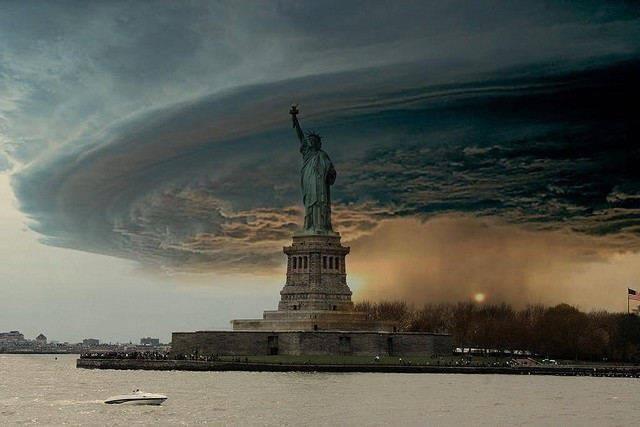
I lifted this image off a friends facebook posting this morning. It kind of sums it all up.

Friday, October 26, 2012

Frankenstorm


My gray hair has led me to become suspect of storm hype in Maryland. I still harbor memories of high school homework deferred, relying on the certainty of our loco meteorologists predicting an approaching storm. The weather professionals would always add “expect school closings and/or delays.” 

I counted on them only to awake to clear skies and business as usual. They failed me. If you've lived in Maryland for any amount of time, they've likely failed you too.

Oddly, as often as not, it is the storms that they don’t call that hit us hardest. Nobody seemed to see that Derecho thing coming four months ago. I challenge anyone to identify a loco meteorologist who even uttered the word “derecho” in a forecast before June 28th.

With this in mind, I ponder the warning of the predicted collision of Hurricane Sandy and a classic nor'easter right smack dab over our heads beginning this Sunday, with some trepidation. Right now my Weather Station wordbones (WSw) is showing a tendency towards high pressure and clear skies. Admittedly my meteorological horizon is more limited than the big picture guys with the serious storm hardware. Those are guys are calling this impending weather event, “Frankenstorm.”

You have to admit that this is a pretty cool name for a storm. This could potentially be one for the books. Forget trick or treating this year. We’re battling a real monster this Halloween!

As of 8:36 this morning, Foot’s Forecast had this to say about Frankenstorm in their posting on Facebook:

“Although the effects of Hurricane Sandy may not reach Maryland until Sunday, it is expected to be a long duration event. If the storm reaches the Delmarva coast as projected, it would produce winds e
qual to or greater than what we all observed with Irene. Impacts would be felt from the New Jersey coast to Norfolk.

From Ocean City to the Baltimore Metro area, sustained tropical storm force winds for a 24 hour period with higher gusts is not impossible, if there is a slow-moving system is crossing the state from east to west.”

I have a lot of respect for the accuracy of the Foots folks. I’m a Foots fan.

Prudence suggests proper preparations; water, check, flashlights with batteries, check, wine, check.

We’ll be ready at WSw. As long as I have service I’ll post about the readings of my little loco snapshot of the storms progress. If there are other HoCo loco weather geeks out there with their own set ups who feel like sharing, drop me an email at wordbones@verizon.net. Send pictures too, if you’d like. I’ll put up as much as I can. 

Right now WSw is reporting a temperature of 61.2 degrees, 85% humidity, and pressure at 29.91inHg. Calm.

In the meantime, check those batteries.